Mamucium: Manchester Roman Ruins
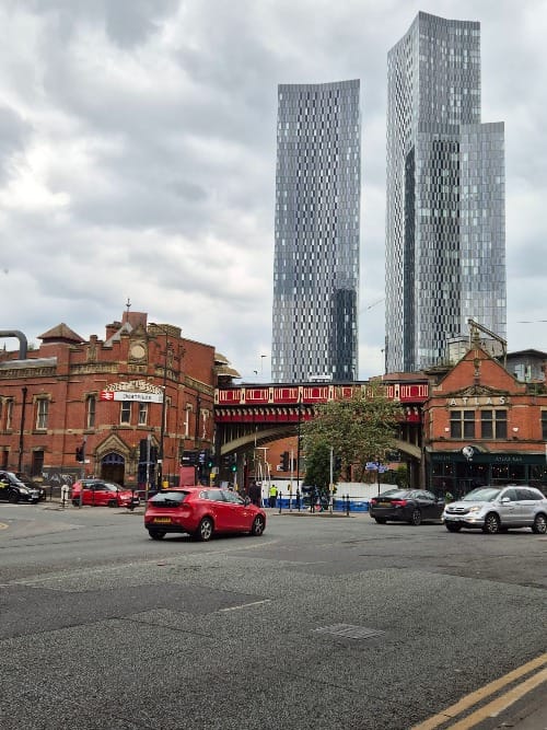
The city of Manchester is one that almost perfectly combines old industrial and new glass and skyscraper skylines. There are brick warehouses throughout the whole city centre that are offset by the modern buildings, plus lots of green spaces as well giving the city a clean look.
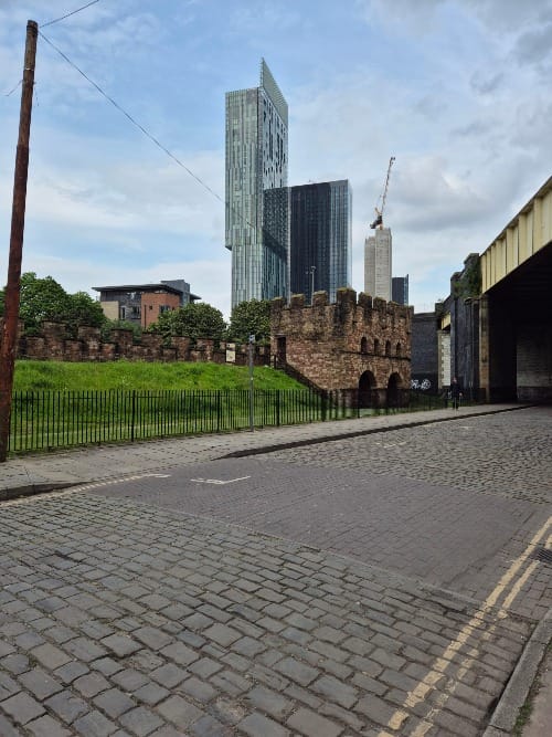
A short walk out of the city centre, surrounding the train tracks coming in from the countryside, is the area known as Castlefield. In it is evidence of the city's long history - Roman ruins, the waterways that aided the city's industrial growth, science and industry museums, and housing ranging from the 18th to 21st century.
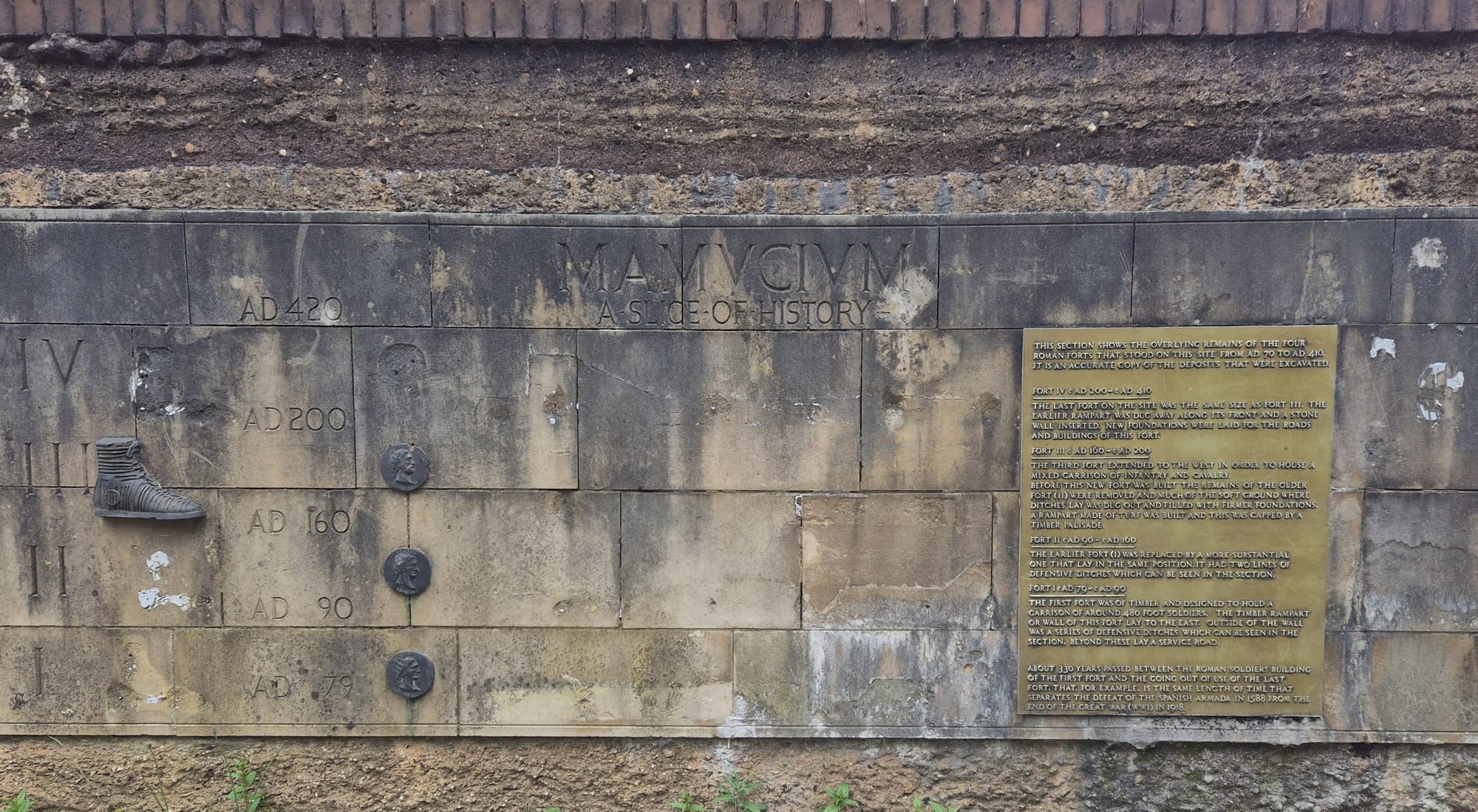
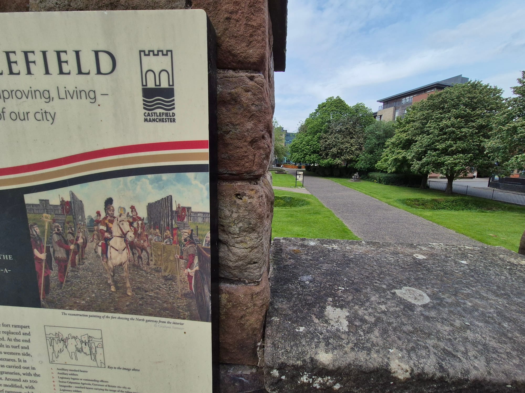
The Roman ruins were not something I was expecting to find however it was a pleasant surprise and, as happens in the UK quite often apparently, can literally be stumbled upon. A wall featuring the Latin name for the city - Mamucium - displays the archaeological levels of the Roman site from first Roman occupation through to the desertion of the British Isles by the 5th century. Four forts were built over the period of occupation and the wall signage briefly runs over the differences between the versions.
There are a few things to look at. Initially, behind the wall showing the fort levels there is a solid outline of the granaries which used to lie just outside of the defensive walls. Climbing up an installed set of stairs, you can see over the reconstructed rampart to defensive ditches on the other side. Signage around the site shows old photographs from original archaeological works on the site and runs through what people are seeing in front of them. There's also some pictures of archoleogical remains that are now housed in local and further reaching museums.
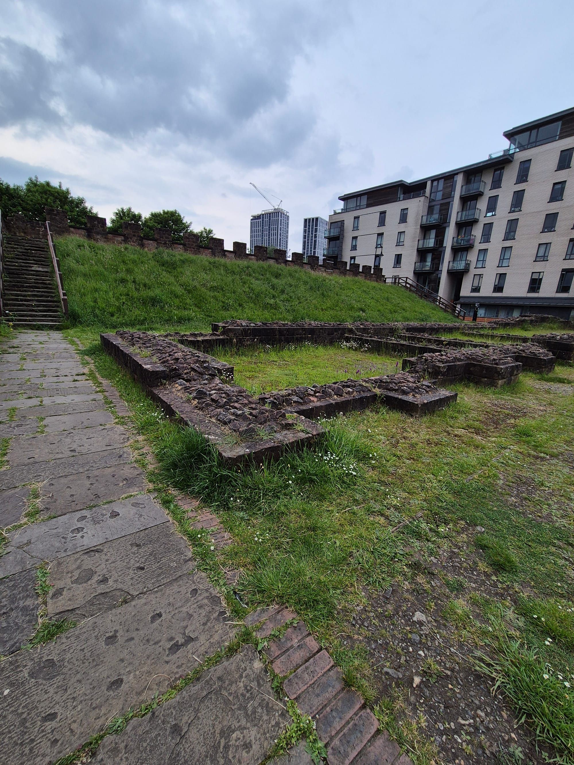
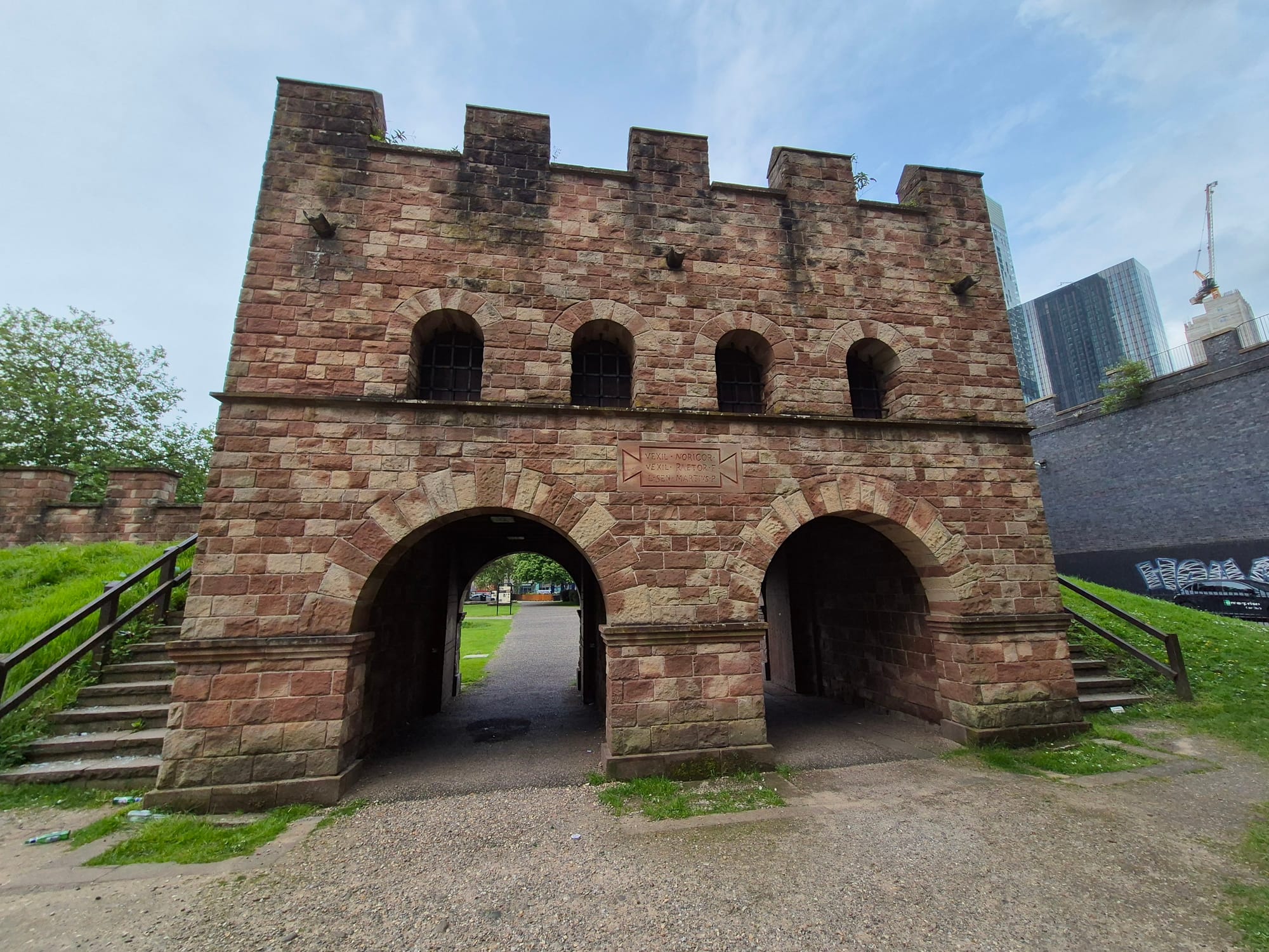
A street sign points to further remains down the road (feature image). The team behind the remains has done a good job of reconstructing but only doing enough that you can see what the remains would have been without giving away the whole thing and making it an obviously new building. This section is where the main fort was built, lying on the road between the major forts of Chester and York, and Carlisle on the way to Hadrian's Wall. The signage links to the previous section, explaining what led to the fort expansion causing the granaries to be built. It also explains what remains used to be in the area that can no longer be seen. There's also just a couple of drawings that show how the areas might have been used which, with their placement, was actually quite evocative.
The road above is the one that led through the vicus, the town that developed around the fort. There are some reconstructed foundations showing where a possible shop, inn, and house would have been. More signage explains the reconstructed Latin inscriptions on the gateway, featuring dedications to Septimius Severus and his sons, Antoninus Pius and Geta.
TIME: I spent about 1 hour walking around but it could easily be seen within 30 minutes or less.
ABILITY: Most everything can be seen from street level with flat paths. There are a couple of sections with stairs but these can be avoided easily.
FACILITIES: Detailed signage.